Er Hatere
2026
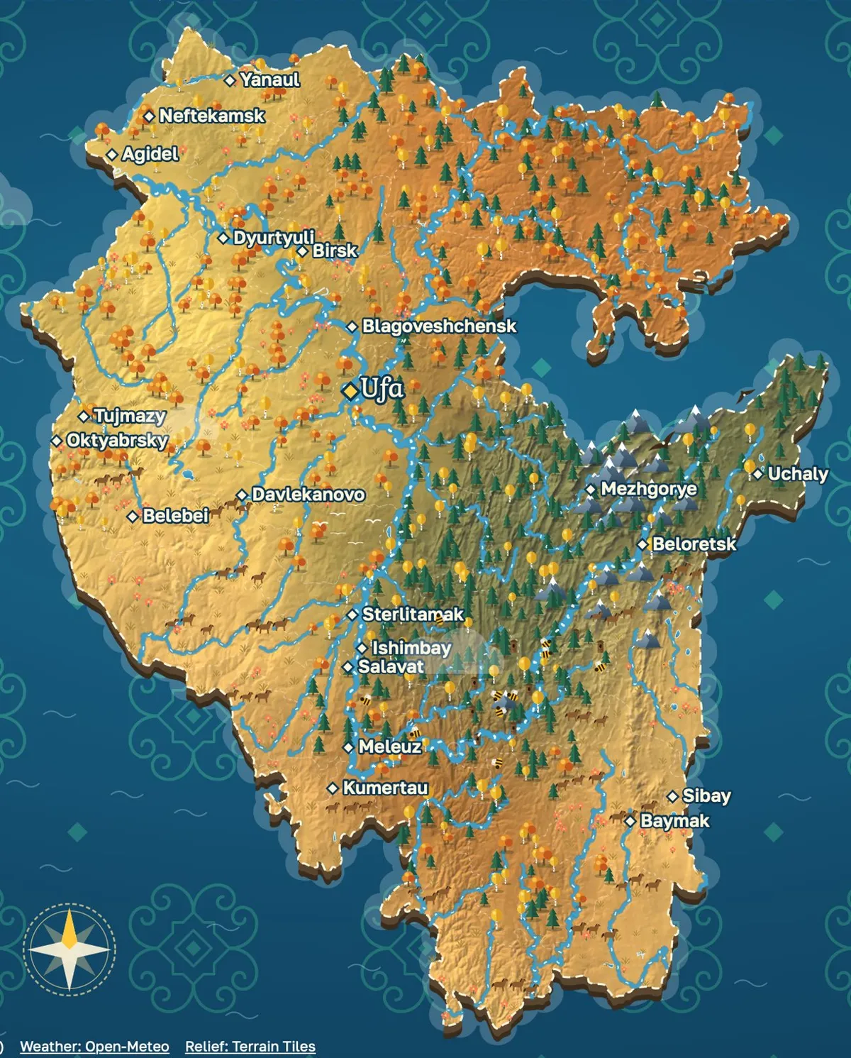
An illustrated map of Bashkortostan where every place name has a voice, a sound and a story.
- Format
- Illustrated multimedia map of Bashkir place names, in the browser, in Bashkir, Russian and English
- My part
- Everything: idea, design, map engine, data, sound, code
- Tools
- Astro · TypeScript · SVG · Supabase · PostGIS · Open-Meteo · Python · Netlify
Er hatere is Bashkir for “memory of the land”. Many names of rivers, springs and villages in Bashkortostan now live only in the speech of older people, and once that voice is gone, a book can’t bring it back. I looked for a map that brings Bashkir place names, living voices and the sound of nature together, and found nothing. So I made one you look at, listen to and move through, like an illustrated atlas of fairy tales.
The map is my own, with no Google or Yandex underneath. Borders and rivers come from OpenStreetMap, the relief from real elevation data, and on top go forests, steppe flowers, horses, beehives and eagles. It follows the calendar through four seasons, and clouds, rain and snow follow the real weather over the republic. That's 63 districts, about 4,500 towns and villages and 725 named rivers and lakes, all in three languages, Bashkir first.
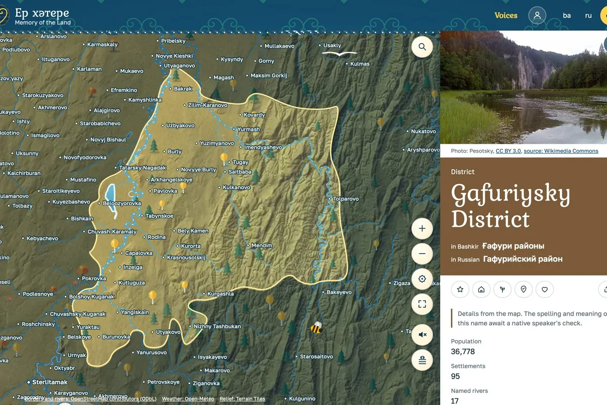
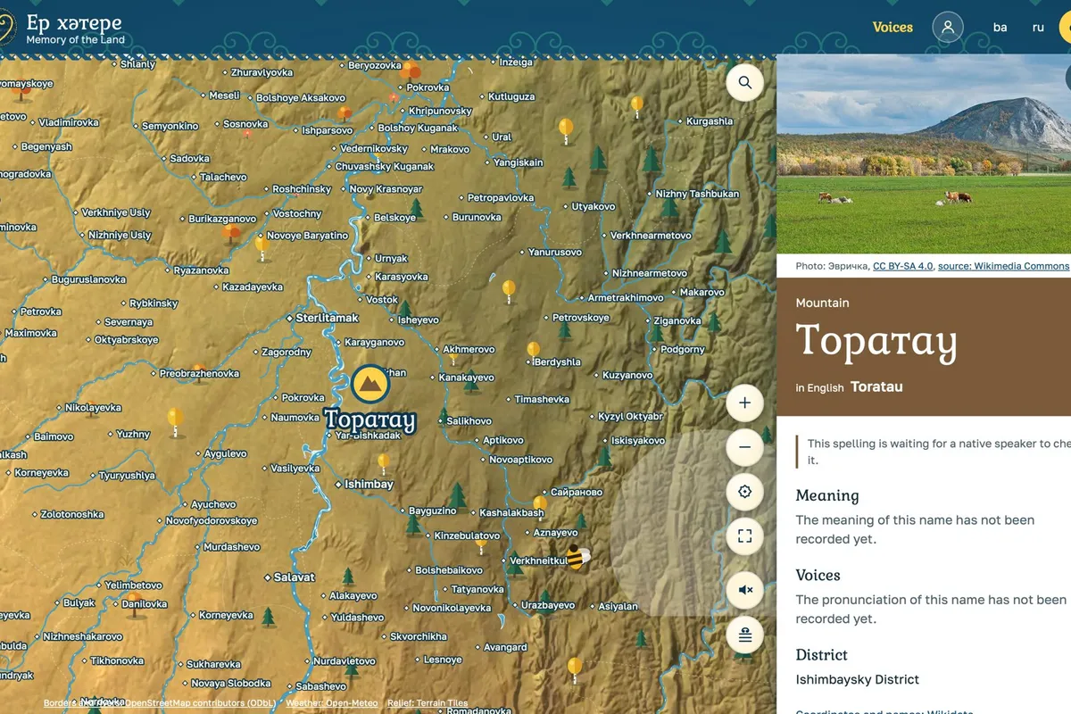
Everything opens with a click. A district glows with its name, the map flies in and a card opens: names in Bashkir, Russian and English, a photo with its author and licence, the meaning, voices and sources. Every village, river and mountain has a card of its own, Toratau among them. Where nobody has recorded a name yet, the card says it's waiting for a native speaker instead of making something up.
With sound on, the land breathes. Real field recordings of water, wind, birds, bees and storms change with the place, the season and the weather. Every place can keep recordings of people saying its name, and the first voice is my grandmother's. For that there's a recording mode: you sit with an elder, the name comes up, you record and move on. A voice goes on the site only with the speaker's consent, and sacred places, Shulgan-Tash first, are hidden from the map.
The map engine is written by hand, two SVG layers with no map library. Scripts turn OpenStreetMap, elevation data, Wikidata and Wikimedia into map files and seasonal relief tiles, and the database is Supabase with PostGIS. The site works as a preview and stays out of search until launch. The main thing isn't done yet: recording sessions with native speakers, and a native speaker's check of every Bashkir text.